Stillwater County, Montana
Stillwater County
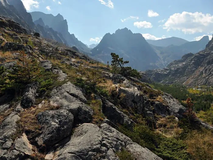
Geographically, Stillwater County boasts diverse landscapes:
- Southern Region: Features the scenic Beartooth Absaroka Wilderness Area.
- Central Region: Home to the pristine Stillwater and Yellowstone River valleys.
- Northern Region: Characterized by lake basins, coulees, and rolling plains.
Elevations in the county range from approximately 3,400 feet near Park City to over 12,000 feet at Granite Peak, Montana’s highest point, located on the southern boundary.
A 75-mile scenic route begins in Columbus and travels through Absarokee, Fishtail, Dean, and Nye, offering travelers peaceful surroundings and breathtaking views.
The Lewis and Clark Expedition traversed parts of present-day Stillwater County during their return journey in 1806, covering areas near Reed Point, Columbus, and Park City en route to Pompey’s Pillar National Historic Monument, which bears the only surviving physical evidence of the expedition.
In the northern areas around Rapelje and Molt, wildlife often outnumbers residents. The Hailstone and Halfbreed National Wildlife Refuges provide unique recreational and sightseeing opportunities.
For those traveling to Yellowstone National Park, the “Gateway to the Beartooth Highway” offers a scenic route described by Charles Kuralt as “one of the ten most scenic routes in the world.”
Stillwater County hosts a variety of activities for residents and visitors, including scenic outdoor recreation, historical sites, and community events throughout the year. The local economy is driven by agriculture and mining, with support services, small businesses, and retail trade playing significant roles.
Educational opportunities are provided by several elementary school districts and five high school districts serving the communities of Absarokee, Columbus, Park City, Rapelje, and Reed Point.

Towns in Stillwater County:
-
Absarokee
-
Columbus (county seat)
-
Fishtail
-
Nye
-
Park City
- Rapelje
-
Reed Point
-
Molt
-
Dean
-
Limestone
-
Wheat Basin
